Norbert weakens to remnant low, more rain heading toward Hawaii
Norbert has weakened into a remnant low in the Central Pacific, but moisture from its remains is expected to bring heavy rain, muggy weather and a potential for flooding to Hawaii later this week.
Read more Clippers, Raptors complete Kawhi Leonard trade after NBA doles out punishment
The Central Pacific Hurricane Center issued its final advisory on Norbert at 5 a.m. today, placing the center of the post-tropical cyclone about 780 miles east of Hilo. The system carried maximum sustained winds of 35 mph while moving west at 13 mph. Forecasters expect the remnant low to gradually dissipate on Wednesday.
National Weather Service forecasters in Honolulu said light to moderate tradewinds will strengthen through Wednesday. Moisture from the remains of Norbert is expected to move through the islands late Wednesday night through early Friday, bringing a sharp increase in shower coverage.
Instability in the atmosphere could trigger isolated thunderstorms and heavy downpours, and weather officials noted a flood watch may be needed as the system gets closer. High pressure to the northeast will push moderate to breezy tradewinds across the state starting Wednesday and lasting into early next week.
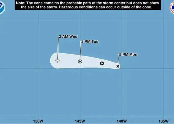
Farther east, Tropical Depression Fifteen-E continues its westward march across the Eastern Pacific.
As of 5 a.m. today, the depression was located about 1,025 miles west-southwest of the southern tip of Baja California, packing maximum sustained winds of 35 mph while moving west at 12 mph, according to the National Hurricane Center in Miami.
Forecasters said dry mid-level air drawing into the system should limit significant development, though it could briefly become a tropical storm before weakening late Wednesday or Thursday as wind shear increases. The system is expected to degenerate into a remnant low by Friday.
Read more Rainbow Warriors overcome scary moment to break through for first win
Weather officials noted a second round of enhanced showers could reach Hawaii early next week as moisture from the remnants of Fifteen-E moves into the area.
Swell conditions will also increase this week along south-facing shores due to a series of long-period south to southwest swells, which could approach advisory thresholds by this weekend. Surf along east-facing shores will gradually increase as tradewinds strengthen and a small swell generated by Norbert arrives.
Fire weather risk remains low through the rest of the week due to recent and upcoming rainfall keeping vegetation moist.
For today, the National Weather Service forecasts mostly sunny skies across Kauai County, Oahu and Maui County, with scattered showers over windward and mauka areas, and isolated showers for leeward sections. Highs will range from 85 to 90 degrees with east winds from 15 to 20 mph. Tonight will turn partly cloudy with scattered evening showers windward and over mountains, becoming numerous after midnight, while leeward areas see isolated evening showers. Lows will range from 75 to 80 degrees with northeast winds around 15 mph.
For the Big Island today, skies will be mostly sunny with scattered morning showers and isolated afternoon showers. Highs will range from 87 to 92 degrees with northeast winds around 15 mph. Tonight will bring mostly cloudy skies and numerous showers to windward areas, while leeward sections will be partly cloudy with isolated evening showers. Lows will range from 73 to 78 degrees with northeast winds around 15 mph.
Read more Under bill, county would be required to prioritize use of native plants