Hurricane Fausto continues spiraling toward Hawaii
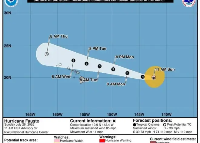
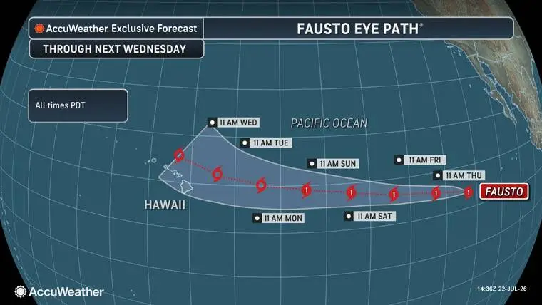
Meteorologists at AccuWeather have mapped a computer track that forecasts Hurricane Fausto crossing into the Central Pacific and passing slightly north of Hawaii Island early next week.
Read more Vulcans to host UH Manoa for season -opening women’s volleyball exhibition
Fausto is a Category 1 hurricane located far southwest of Mexico’s Baja California Peninsula. The cyclone is expected to strengthen while tracking across the open eastern Pacific Ocean and could reach Category 2 intensity before moving over cooler waters and encountering stronger wind shear, which is expected to cause it to lose wind intensity.
“It is rare that a hurricane makes a direct hit on Hawaii. The cooler waters east of Hawaii often cause approaching hurricanes to lose wind intensity,” said AccuWeather Hurricane Expert Alex DaSilva. “This is what we expect with Fausto.
“Still, Hawaii will need to monitor the progress of Fausto, as it is forecast to move near the islands next week as a tropical storm.”
At 5 p.m. today, the center of Fausto was about 925 miles west-southwest of the southern tip of Baja California. The storm has maximum sustained winds of 80 mph, with locally stronger gusts.
Read more Country Club property draws interest; state orders structural inspection
According to the National Hurricane Center in Miami, Fausto is moving to the west-northwest at about 8 mph. It is forecast to increase in speed over the next several days. Slight strengthening is possible during the next day or so, followed by gradual weakening on Friday and into the weekend.
Hurricane-force winds extend outward up to 45 miles from Fausto’s center, and tropical-storm-force winds extend outward up to 195 miles.
While Fausto is not yet having an effect on Hawaii, swells generated by Fausto are affecting portions of the west coast of the Baja California Peninsula and are spreading northward toward the coast of southern California.
Meanwhile, on Fausto’s heels and off the western coast of Guatemala, a broad low-pressure system dubbed Disturbance 1 by forecasters is producing a large area of disorganized showers and thunderstorms. NHC forecasters predict at 50% chance the disturbance will develop into a tropical cyclone in the next 48 hours and a 90% chance over the next seven days.
Read more Remembering Mackenzie: Valentin leaves lasting Vikings’ legacy
Email John Burnett at [email protected].